


Space technology isn’t just for astronauts anymore.
For years, satellites seemed distant—literally up there in the sky and figuratively far from our day-to-day work. We used them for GPS, weather updates, or tracking planes—but the idea that satellites could influence everyday business felt like science fiction.
That’s changing—fast.
Today, satellites are quietly transforming businesses around the world. They help farmers know exactly when to water crops, insurers assess storm damage before claims are even filed, and utilities locate underground leaks without digging up roads.
Here’s how space technology is moving from orbit to office – and why Nigerian businesses should pay attention.
What’s Really Happening Up There?
Three big trends are driving this change:
- Satellites are smaller and cheaper – Companies like Planet now operate hundreds of tiny satellites that capture images of the entire planet every single day.
- AI makes sense of the data – Machines now detect patterns that previously needed expert teams of analysts, enabling businesses to quickly derive actionable insights from vast amounts of satellite imagery.
- Business access has grown – more companies than ever can use satellite data to make decisions.
The result? Space is not just for governments or billionaires. It’s a powerful tool for everyday business intelligence.
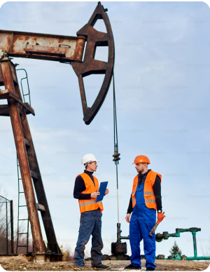
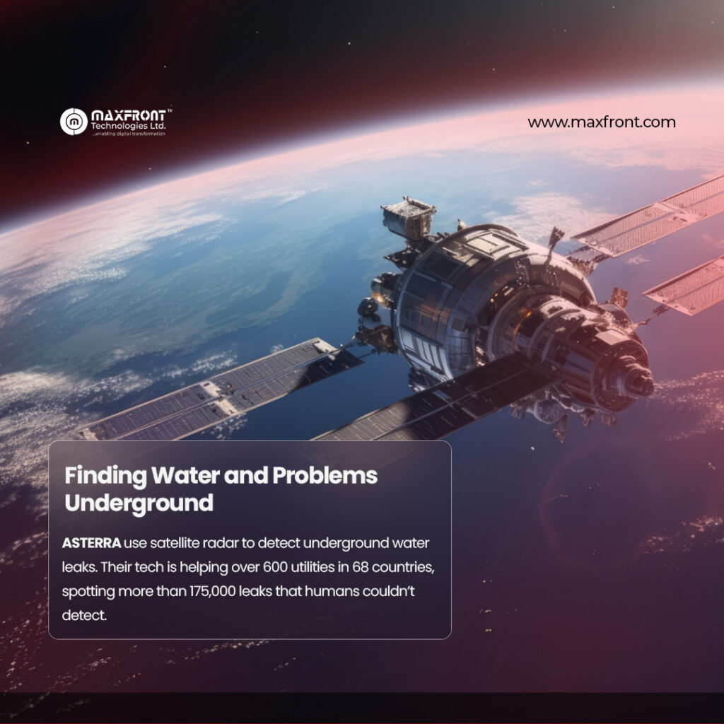
Finding Water—and Problems—Underground
Take ASTERRA for example. They use satellite radar to detect underground water leaks. Their tech is helping over 600 utilities in 68 countries, spotting more than 175,000 leaks that humans couldn’t detect.
Consider this—a satellite is able to identify a leak before it becomes visible to anyone. Utility companies save millions of litres of water, cut energy costs, and avoid tearing up city streets. The same tech monitors soil beneath roads, railways, and dams, predicting issues before they become disasters.
Source: Engineering News-Record (ENR), New Mexico Deploys Satellites, AI to Detect Water Leaks, Dec 15, 2025.
Advancing Global Agriculture Through Satellite Technology
Farmers are already experiencing the benefits of satellite technology.
- John Deere leverages NASA satellite data to optimize water and fertilizer application, ensuring resources are used precisely where needed.
- In Tanzania, NASA Harvest gathers rice data from more than 800 farmers to forecast yields and help prevent shortages.
- The Japanese company Space Shift automatically identifies abandoned farmland, reducing inspection workloads by 50%.
Farmers receive clear alerts indicating which fields require attention, rather than reviewing satellite images themselves.
Enhancing Supply Chain Visibility
While global trade is complex, satellites simplify the process of tracking goods.
- Cargill uses satellites to monitor forests and verify that its products are deforestation-free.
- Maersk has equipped over 330 ships with Starlink broadband, enabling cloud-based tools and remote management at sea.
If a product crosses international borders, it is likely being tracked by satellites.
Source: Cargill Official Website, Monitoring & Verification
Insurance Made Smarter
Insurance loves predictability—and satellites deliver it:
- Swiss Re uses near-real-time flood maps to speed up claims and disaster response.
- NASA & WTW integrate decades of satellite data with AI to improve storm forecasting, making coverage fairer and more reliable.
When hail or flood hits, satellites see it first. This helps insurers price coverage accurately—and helps farmers and homeowners sleep easier.
The Challenge: Making Space Data Work
Here’s the catch: satellite data is useless if it’s too complicated to use.
A UK study, Unlocking Space for Business, found that many businesses are “scared of space.”. They face technical jargon, unclear pricing, and difficulty measuring ROI. Only 5% of 300 case studies reviewed had a clearly measured return.
The message? Make space data simple, practical, and relevant.
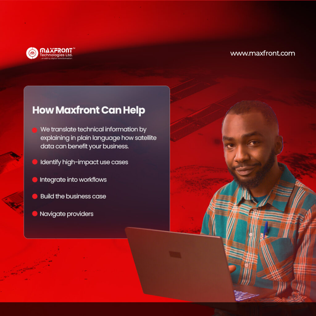
How Maxfront Can Help
At Maxfront Technologies, we help businesses turn complex space data into practical solutions:
- We translate technical information by explaining in plain language how satellite data can benefit your business.
- Identify high-impact use cases: Supply chain, asset management, climate risk—we show where satellites make a real impact.
- Integrate into workflows: Insights are embedded directly into the systems your team already uses, such as project management tools or data analysis platforms, ensuring seamless access to satellite data for improved decision-making.
- Build the business case: We quantify potential ROI and help you secure internal approval.
- Navigate providers: With many satellite data providers, we help you pick partners who actually deliver by evaluating their reliability, service quality, and alignment with your specific business needs.
The Bottom Line
Space tech is no longer exotic—it’s operational.
From water utilities in Europe to farmers in Africa to insurers in North America, businesses are using satellites to make smarter decisions, cut costs, and serve customers better.
The winners won’t be the ones with the fanciest satellites—they’ll be the ones who make satellite data work for real people, in real business.
At Maxfront Technologies, we build those bridges.
Ready to see what satellite data can do for your business?
Reach out at info@maxfront.com.